
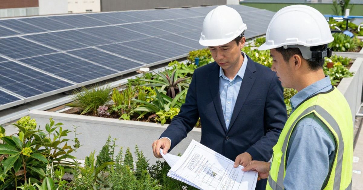
As businesses across sectors increasingly rely on technology for efficiency, the role of drones has become more important than ever. From construction and agriculture to energy and infrastructure, drones are being used to collect precise, real-time data that can drive decisions and improve productivity. The heart of this transformation lies in drone data software — a critical tool that allows users to manage, process, and analyze aerial data captured by drones.
This blog explores how drone data software is being used to improve inspections, project planning, and operational insights. We will also take a closer look at its use in roofing inspections and how roof inspection software is redefining maintenance strategies for residential and commercial properties.
What Is Drone Data Software?
Drone data software refers to a digital platform that processes, visualizes, and interprets data collected by drones. This data can include high-resolution images, thermal scans, LiDAR information, and geospatial coordinates. Unlike traditional data analysis tools, drone data software is specifically designed to work with aerial data formats, offering industry-specific outputs like orthomosaics, point clouds, contour maps, and 3D models.
The software streamlines data workflows, allowing teams to collect insights faster, make more informed decisions, and reduce manual labor. Its applications are far-reaching and include everything from asset monitoring and agricultural planning to construction progress tracking and disaster response.
Core Features of Drone Data Software
The functionality of drone data software can vary depending on its intended use, but some core features include:
Georeferencing: Aligns drone images with real-world coordinates for accurate mapping.
Image Stitching: Merges multiple aerial images into a single cohesive map.
3D Modeling: Generates digital models of terrain, structures, or infrastructure.
Measurement Tools: Calculates distances, areas, and volumes directly within the software.
Reporting Capabilities: Provides structured outputs for easy interpretation and decision-making.
These features reduce the need for physical presence on-site and enable precise measurements without complex equipment.
Applications Across Industries
Drone technology, supported by intelligent software, is making a major difference in multiple industries. Here are a few notable examples:
Construction
Project managers use drone imagery and models to assess site conditions, monitor project progress, and ensure compliance with timelines. The data collected helps reduce costly delays and improve team coordination.
Agriculture
Farmers and agronomists use drones to assess crop health, monitor irrigation, and detect pest infestations. Drone data software processes the data into actionable insights that improve yield forecasting and resource allocation.
Energy & Utilities
Inspection of wind turbines, power lines, and pipelines becomes safer and more efficient with drone-based monitoring. The software identifies faults or maintenance needs through high-resolution imaging.
Real Estate & Infrastructure
In the real estate sector, drone mapping offers dynamic views of properties, while infrastructure teams use aerial assessments for road maintenance and urban planning.
The Role of Roof Inspection Software
While the broader capabilities of drone platforms are well-known, one of the fastest-growing and highly specialized areas is roof inspection software. This software focuses specifically on evaluating the condition of roofing materials, identifying defects, and ensuring compliance with building codes.
Why Use Roof Inspection Software?
Traditional roof inspections are often risky, time-consuming, and dependent on weather conditions. Climbing ladders, working at height, and covering large surfaces pose safety hazards for inspectors. Roof inspection software, combined with drone imaging, removes these challenges entirely.
By flying over a structure and capturing high-definition images, drones can assess a roof’s condition in a matter of minutes. The software then analyzes these images to identify issues like:
Cracks or splits in roofing materials
Debris buildup
Ponding or water damage
Missing or damaged shingles
Flashing or gutter faults
Benefits of Drone-Based Roof Inspections
Safety: Eliminates the need for physical climbing and reduces the risk of falls.
Speed: Entire inspections can be completed in a fraction of the time.
Accuracy: Provides detailed visual documentation that can be revisited later.
Cost-Efficiency: Reduces labor and equipment expenses.
Documentation: Offers historical data for insurance claims or repairs.
For building contractors and facility managers, the ability to generate precise reports using roof inspection software ensures faster turnaround and fewer liabilities.
Integrating Drone Software into Business Operations
Adopting drone data software requires more than just purchasing a license. Organizations must train staff, set data management protocols, and ensure compliance with aviation regulations. However, the investment is justified by the immediate value in reduced operational costs, higher safety standards, and more reliable data insights.
A few practical tips for businesses considering integration:
Choose software that supports your drone’s hardware and output formats.
Evaluate whether the platform provides offline and cloud-based processing.
Consider customer support and regular software updates as important features.
Ensure the software complies with local data protection laws, especially when handling sensitive geospatial information.
With the right implementation, businesses can expect improved project timelines, reduced resource wastage, and clearer communication among teams.
Future Trends in Drone Data and Roof Inspection Software
The future of aerial data software lies in automation and artificial intelligence. Machine learning algorithms are being integrated to automatically detect features, classify objects, and predict structural issues. This is especially promising for roof inspection software, where AI can automatically flag anomalies without human intervention.
Additionally, we can expect more real-time analytics, edge processing capabilities, and seamless integration with other industry tools such as Building Information Modeling (BIM) platforms.
As adoption increases, software will become more specialized and accessible, empowering businesses of all sizes to benefit from drone technologies.
Conclusion
The demand for accurate, fast, and reliable aerial data continues to rise, making drone data software a core element of modern digital infrastructure. When paired with specialized solutions like roof inspection software, businesses can not only enhance safety and efficiency but also gain deeper insights that improve long-term planning.
For companies exploring aerial solutions to transform their operations, Asteria Aerospace stands out for its advanced drone capabilities and commitment to innovation in unmanned aerial systems.


Leave a Reply